tree day
Environment news · Development: 28 Oct 2026
Cyclone Arnab makes landfall on India’s Andhra Pradesh and Yanam coast
Arnab made landfall on India’s Andhra Pradesh and Yanam coast on 28 October. NASA published a nighttime satellite view showing the cyclone offshore before it reached land.
Andhra Pradesh and Yanam, India
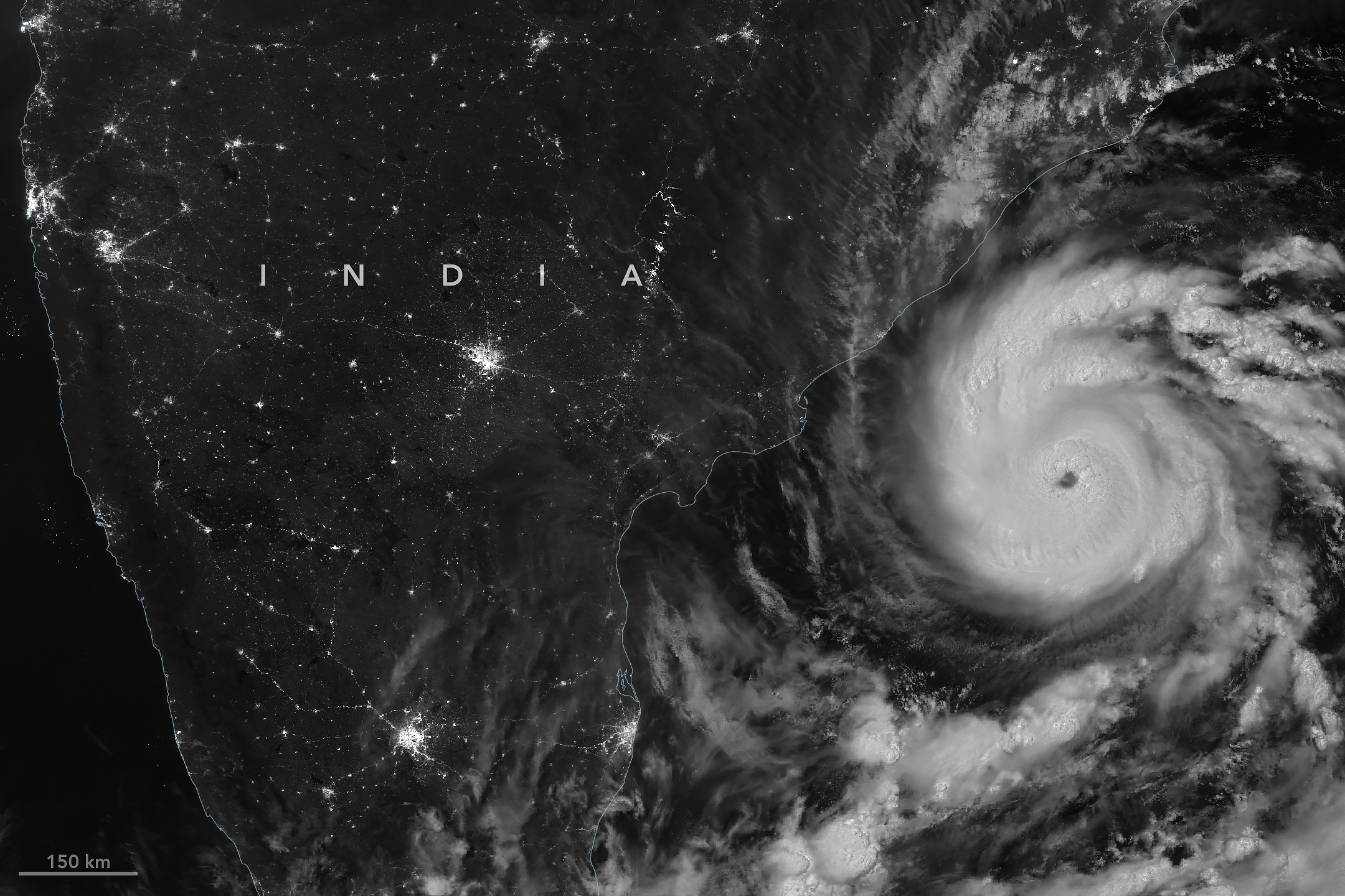
Cyclone Arnab made landfall on the Andhra Pradesh and Yanam coast early on 28 October, NASA Earth Observatory reported the following day. Citing the India Meteorological Department, NASA put sustained winds at landfall at 130 kilometres per hour. The agency also published a satellite image taken before the storm came ashore. [1]
A nighttime view before landfall
NOAA-20’s VIIRS instrument captured the storm at 20:12 UTC on 26 October, equivalent to 1:42 a.m. in India on 27 October. NASA reported landfall between Bapatla and Visakhapatnam, along a coast with cities, farmland and fishing communities. [1]
Keeping the image time beside the landfall date matters. The picture shows the cyclone’s structure at one observation time offshore; it cannot show conditions in every community after landfall. The wind figure is an IMD estimate reported by NASA, rather than a damage assessment derived from the picture.
Local assessments will fill in the picture
The landfall report establishes when and where the storm reached the coast. Assessing its consequences requires additional local information about conditions, services and recovery. Satellite observations can support that work, but their regional view answers different questions from observations on the ground.
Weather guidance distinguishes an outlook from the conditions actually observed at a location. [2] The same care is useful when reading a storm image after landfall: match each piece of evidence to its time, place and purpose. Subsequent IMD and local assessments can add detail beyond this initial satellite account.
Follow the evidence
Primary reporting and background sources. Event dates and publication dates are shown separately above.
Read our editorial standards. Have a correction? Identify the article and relevant source in your feedback to the site owner.