tree day
Environment news · Development: 15 Oct 2026
NASA satellites track rising fire activity in the central and eastern Amazon
NASA reports increased fire activity and smoke across parts of the central and eastern Amazon, with an October satellite image showing smoke along the river near Manaus and Santarém.
Amazon basin, Brazil
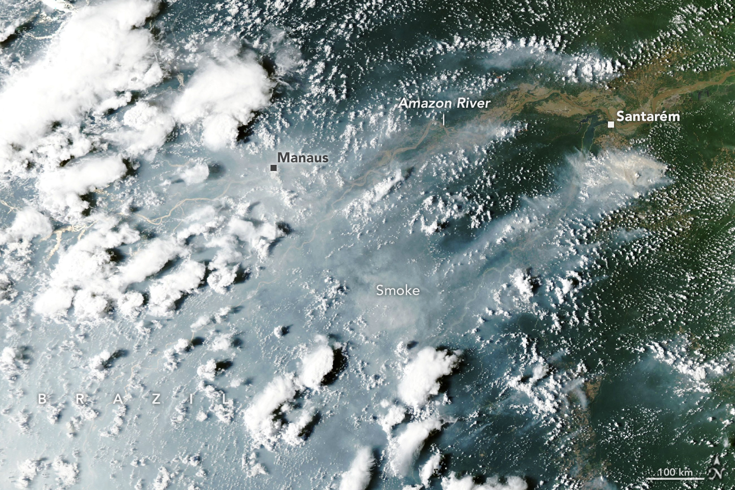
Satellite systems detected sharp increases in fire activity and smoke emissions in Brazil’s central and eastern Amazon beginning in September, NASA Earth Observatory reported on 15 October. An Aqua satellite image taken on 12 October showed smoke on both sides of the Amazon River, with heavy smoke affecting Manaus. [1]
Drought raises the stakes for forest fires
NASA’s scientists linked the regional fire pattern to rainfall disruption during El Niño. They described management fires escaping into dry forest understory and warned that some fire activity could continue until seasonal rains arrive. That outlook was a forecast, while the satellite detections documented activity already underway. [1]
Smoke makes the story an immediate concern for people as well as forests. The US Environmental Protection Agency identifies fine particles as a major component of wildfire smoke and explains that smoke can affect air quality beyond the burning area. [2] Local air-quality observations add information that a regional fire map cannot provide.
What satellites can miss
NASA notes that clouds, dense smoke and tree canopy can obscure fire signals, particularly from lower-intensity burning beneath trees. [1] A gap in visible detections can therefore reflect a gap in observation, rather than confirmation that a fire has stopped.
Active-fire detections and burned-area measurements answer different questions. The former help locate activity when a satellite passes overhead; the latter help establish the extent of land affected. Reading the observations together with field information will be important for assessing forest damage as the season develops.
Follow the evidence
Primary reporting and background sources. Event dates and publication dates are shown separately above.
Read our editorial standards. Have a correction? Identify the article and relevant source in your feedback to the site owner.